At SNAs, step off the beaten path
To get a piece of quiet, visit one of many state natural areas.
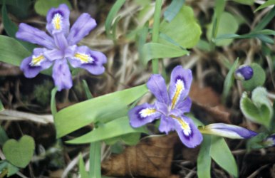
© Beth Gauper
One spring, I hit the nature-lover's jackpot, almost without trying.
Exploring a septet of Minnesota's scientific and natural areas, or SNAs, I found more pasque flowers in bloom than I'd ever expected to see in a lifetime.
I saw a panorama of the Mississippi as the Dakota would have seen it 200 years ago. I walked under the budding canopies of old-growth forests and listened to choruses of courting frogs.
Wow! An SNA, it turns out, is a fantastic place to see spring at full throttle.
These scientific and natural areas — in Wisconsin, state natural areas — are good places to look for wildflowers and wildlife, like state parks.
But they have no amenities beyond small parking areas and an interpretive board; visitors are expected to tread lightly and use their own eyes, ears and noses to find out what a site has to offer.
Not only will you be getting off the beaten path, usually there is no path.
Set aside to make sure none of the state's ecological diversity is lost, each natural area preserves a pocket of land that is extraordinary in some way. Some are home to rare species or the last remnants of prairie or Big Woods.
Some tell a geological story, showing signs from eras when the land was covered by volcanoes, then a tropical sea, then sheets of ice.
And they're all beautiful. Unfortunately, that means it isn't easy to protect them as the state's human population increases and fans out, casting an acquisitive eye over the land.
"We're competing with those who have the income and would like to put a house in the woods or on top of a bluff," said Bob Djupstrom, retired supervisor of the Minnesota SNA program. "By the same token, more and more people are aware of the need to protect and preserve these kinds of places."
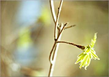
© Beth Gauper
A great view of the Mississippi
My first "Wow!" came at one of Pine Bend Bluffs SNA, just south of St. Paul.
Parking near a trucking company just off U.S. 52 in Inver Grove Heights, we walked along a gravel lane between two ravines and up a knoll, emerging to a spectacular view of the Mississippi's main channel amid a maze of islands and sloughs.
Hawks wheeled overhead, birds trilled from oak forest and boats puttered by 200 feet below.
"It's the best view of the lower Mississippi in the metro area; it's just phenomenal," Djupstrom says. "It's a great place to see eagles in the spring and hawks in the fall."
But it didn't come cheaply. The site, identified as "one of the last best places" by the Minnesota County Biological Survey, had a house on it, with a deck that jutted over the bluff.
With the help of $500,000 from longtime SNA supporters Bruce and Ruth Dayton and Mary Lee Dayton, the national Trust for Public Land bought the house, tore it down, put back the dry, sandy soil that was original to the site and planted it with prairie seeds harvested from Grey Cloud Dunes SNA.
Then, the trust offered it to the state for $240,000, which it got from the Environmental Trust Fund.
"Now, it's open to everybody in Minnesota and everybody who's passing through Minnesota," Djupstrom says. "You can see what the Mississippi Valley looked like way back when."
From Pine Bend, we drove down U.S. 52 to Cannon Falls, where we headed east on Minnesota 19. As we crossed the Cannon Valley Trail, we could already see River Terrace Prairie, a mound of gravel deposited by meltwater at the end of the last Ice Age, rising out of the river flats.
According to the Minnesota SNA guide, "Spectacular displays of pasque flower are found in early spring." But it was only the middle of April, so we weren't hopeful as we followed a path beaten through yellowed prairie grasses.
Then we saw a cluster of the large, delicate blooms off to our left, nodding on feathery stems. By the time we reached the top of the ridge, the sunny western slope was covered with thousands of the pale-lavender flowers, so many we had to watch where we put our feet.
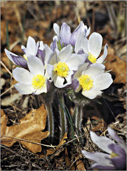
© Beth Gauper
For a first sighting of spring wildflowers, it was a doozy.
"Only gravel ridges are poor enough to offer pasques full elbow-room in April sun," naturalist Aldo Leopold wrote in "A Sand County Almanac." "They endure snows, sleets and bitter winds for the privilege of blooming alone."
Not that long ago, the ridge was covered with red cedars, and only a few pasque flowers bloomed beneath them. But, with prescribed burns to replace the periodic fires that once occurred naturally, the original prairie ecosystem has returned.
Big Woods remnant in the suburbs
A few days later, we drove out to the Twin Cities' western suburbs and Wood-Rill SNA, most of it a gift from Bruce and Ruth Dayton. Named for a Wordsworth poem — a rill is a brook — it's one of the last remnants of the Big Woods, which once covered 2,000 square miles of Minnesota.
The 150-acre preserve also is a souvenir from the Ice Age, with a kettle lake called Bufflehead Pond and terrain that dips and rises. Jack-in-the-pulpit and bellwort grew along the path, and marsh marigolds were nearly ready to pop in a black-ash swamp.
Walking along, we sensed a vibrant layer of life humming along just beyond our perception. As we approached a tamarack swamp and the noisy frogs fell silent, we wished we could blend into the woodwork and just watch.
According to Stan Tekiela, a Minnesota naturalist who often visits SNAs while working on his field guides to amphibians, wildflowers, trees, birds and mammals, that's exactly what visitors should do if they have the time.
"When you show up, all the local wildlife freezes," Tekiela says. "What you have to do is sit down, settle in and wait for them to return to their normal rhythm. Just sit back and lean against a tree; that's the most productive way to see these things."
Our next stop was one of Tekiela's favorites, Wolsfeld Woods, only a few miles away. Settled in 1855 by three brothers from Germany, it was used to produce maple syrup.
It was bought for development in 1961 but in 1978 was donated to the Nature Conservancy, which has helped Minnesota and Wisconsin acquire many of their most spectacular SNAs.
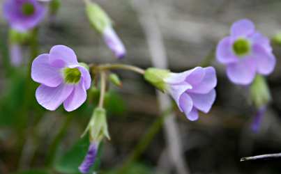
Violets and pale-pink rue anemone grew along the path, which we followed to rush-lined Wolsfeld Lake. From there, we climbed a path at the top of a ravine, through which a creek meandered.
Then, we got lost in the old-growth woods, finding our way back to the parking lot only with the help of traffic noise from County Road 6.
© Beth Gauper
Wildflowers on the St. Croix
We returned to prairie the following week, and by then, spring already had taken a giant leap forward.
On the St. Croix Savanna SNA near Stillwater, a gravel prairie high above the St. Croix River south of Bayport, the pasque flowers were gone, the oaks were dripping with chartreuse baby leaves and the raspberry shoots had turned bright red.
Velvety pussytoes had sprung up along the path, and violets flourished on the southern slope.
Farther south, eight miles beyond Afton, we found more violets at Lost Valley SNA and, we thought, a tiny white draba bloom — "Sand too poor and sun too weak for bigger, better blooms are good enough for Draba," Leopold wrote.
Just overhead, a red-tailed hawk put on a show for us, coasting along on warm breezes, and we stood atop one ridge, gazing across a river of grass at another ridge that was studded with limestone boulders.
The site was poor farmland, but today it supports a rich collection of prairie wildflowers and grasses, and we made a mental note to come back later in the year.
© Beth Gauper
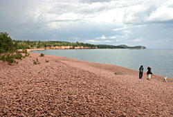
Our last stop was Grey Cloud Dunes SNA in Cottage Grove, where a brisk 20-minute walk took us down a hill into a sumac grove, under a railroad track, through a grassy meadow, past a copse of oak and out onto the banks of the Mississippi, where we annoyed a pair of geese.
It was a lovely spring stroll, perfumed by apple blossoms; by summer, it's overflowing with plants that thrive in a dry, sandy environment.
In May, spring blooms still are found in abundance under the forest canopy and on prairies.
Some of the best are in far southeastern bluff country. At Mound Prairie SNA between Hokah and Houston (see Road trip: Wildflowers of the Mississippi Valley ), visitors find woodland ephemerals as well as prairie flowers flourishing on sun-bathed goat prairie.
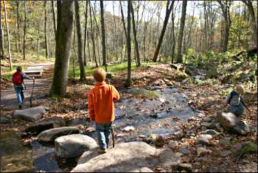
Others that have woodland and prairie wildflowers, as well as mosses and ferns, include Zumbro Falls Woods, along the Zumbro River east of Zumbrota; and Townsend Woods, a patch of Big Woods that's just north of Sakatah Lake State Park, west of Faribault.
© Beth Gauper
An abundance in Wisconsin
Wisconsin also has superb natural areas. Started in 1951, its program got a 23-year head start on Minnesota, giving it 687 sites to Minnesota's 166.
Its sites include many of the state's headliner attractions: the Dells of the Wisconsin River, the Dalles of the St. Croix, Brady's Bluff Prairie in Perrot State Park, Big Bay Sand Spit and Bog on Madeline Island, the Mink River Estuary in Door County.
Door County alone has more than 25 state natural areas, tucked amid the better-known state and county parks.
Wisconsin's very first SNA in 1951 was Parfrey's Glen in the Baraboo Hills. That's one of my favorite spots in the whole region, a narrow, otherworldly gorge whose moss-covered rock walls are embedded with plum-puddingstone.
At all these sites, familiarity breeds affection. There's so much going on there we want to come back and check in every once in a while to see what's new. In that way, they're a little like old friends.
Trip Tips: Natural areas in Minnesota, Wisconsin and Michigan
© Beth Gauper
Minnesota SNAs: "A Guide to Minnesota's Scientific and Natural Areas" includes a statewide map and location maps for the 166 sites.
You can follow the Minnesota SNAs on their Facebook page. There's also a Flickr group with lots of alluring photos.
Wisconsin SNAs: Wisconsin has 687 state natural areas. The guidebook "Wisconsin, Naturally" includes a statewide map and location maps for 150 of them.
Michigan SNAs: Michigan has 46 natural areas, many of them in such familiar places as the Porcupine Mountains and Ludington Dunes.
Iowa State Preserves: Like state natural areas, the 95 Iowa preserves protect outstanding biological and geological features and also historical and archaeological features.
What to do: The sites have paths worn down by hikers, but it's better to spread out to lessen the impact of your visit (except in such sites as Wolsfeld Woods, which asks hikers to keep to paths).
Watch out for ticks; it helps to wear light-colored clothes, so they show up as they try to find a lodging site.
Bring a bag to pick up trash, especially at such sites as Grey Cloud Dunes.
If you like the SNA you have visited, tell your state legislator so the program can continue to get funding.
What not to do: Dogs aren't allowed, except on such sites as Wood-Rill in Orono, and then only on a leash.
Picnicking is not allowed, though hikers can sit on a rock or stump and have a sandwich and drink carried in a backpack.
Picking wildflowers or morel mushrooms is not allowed.