One fall swoop
The roller-coaster hills and riverside bluffs of northeast Iowa yield a photo album of panoramas.

© Beth Gauper
Long before the second-growth forests of Minnesota and Wisconsin's north woods became fall destinations, sightseers were flocking to northeast Iowa.
Flat? Hardly. In this part of Iowa, only the river is flat. Towering bluffs line the Mississippi, providing unparalleled views of the sprawling river plain.
For more than 150 years, people have gone to great lengths to see these views. In 1851, when the town of Lansing consisted of a few log cabins, a 20-year-old steamboat passenger named Harriet Hosmer noticed a particularly steep bluff there.
She asked the captain, who had stopped to take on wood, if she had time to climb it and, when he sent a clerk to escort her, easily beat him in a race to the bluff top. The peak has been called Mount Hosmer ever since.
Young Hattie never came back to Lansing; she finished her art studies in St. Louis and went on to Rome, where she became a renowned sculptor and joined an international circle of artists that included novelist Nathaniel Hawthorne, who modeled one of his characters after her.
Hosmer's bluff, however, has been giving a spectacular front-row seat to tourists ever since.
It's just one of the splendid views along this stretch of the Mississippi, but it may be the best. From Lansing's Main Street, Sixth Street climbs a nearly vertical hillside, past ornate Victorian houses.
Creep still higher and around a few hairpin curves, and you'll see a three-state panorama, including the lacy Black Hawk Bridge and, far below, a labyrinth of islands and sloughs, through which trains inch across dikes, barges push tons of grain, and houseboats putter into marshy corners.
The view is rivaled only by the one from the 500-foot bluffs of Pikes Peak State Park, farther down the river. This part of Iowa not only isn't flat, it's as wavy as a windsock.
In fall especially, tourists beat a path to this corner of Iowa, to follow the river and explore towns that hit their heyday during the Civil War. There's no way to get here that's not extremely scenic.
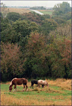
The rolling countryside is at least as beautiful as the riverside, punctuated by old stone churches tucked into the nape of hillsides and an occasional round barn.
In autumn, cotton grass waves in the breeze, and limestone outcroppings became tawny in the slanting sunlight.

© Beth Gauper
Those driving in from the north will arrive in the border town of New Albin. Those coming from the west, through the bluff-country burg of Decorah, can start the route in Lansing.
Tourists know it for its view and for its bridge, named for the Sauk chief whose cornered band was massacred by the cannons of a federal steamboat in 1832, just up the river near Victory.
From Lansing, County Road X52 heads south, passing the lovely stone Wexford Immaculate Conception Catholic Church, built by Irish immigrants around 1868.
Rejoining the river at Harpers Ferry, the road continues to Effigy Mounds National Monument, where entry is free.
Here, atop a rocky bluff, an ancient people left 195 ancient burial mounds, remarkable because 31 are in the shapes of birds, reptiles and mammals, including the 137-foot-long Great Bear Mound.
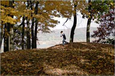
Eleven miles of hiking trails wind through oak and aspen forest on the rim of the bluff, affording spectacular views.
Marquette is three miles south, tucked under the bridge to Prairie du Chien. A crossroads named for Father Marquette, who claimed it for France when he and mapmaker Louis Jolliet emerged from the mouth of the Wisconsin River in 1673.
It's now known for its flea markets, winery and casino boat.
From Marquette, the highway hugs the foot of the bluff on its way to McGregor, called the Pocket City because it's hugged by bluffs; some of the shops on Main Street have back patios that end in sheer limestone.
McGregor rewards those who relish the unconventional.
See amazing sand "paintings" executed inside bottles by a local deaf man who became the darling of his rich Victorian patrons, at the McGregor Historical Museum, and stop by the River Junction Trade Co., a general store for frontier-era re-enactors.
Up U.S. 18, aluminum fishing boats venture in to see the glossy stalactites of Spook Cave, named for the hollow sound of water splashing on rock.
The 500-foot bluffs above McGregor caught the eye of Lt. Zebulon Pike in 1805, when he was scouting for fort sites. The fort instead was built across the river on the Prairie du Chien flats, so Pike's aerie, now Pikes Peak State Park, was turned over to tourists.

© Beth Gauper
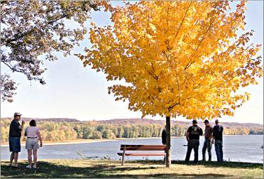
Its views of the river plain, from overlooks and 12 miles of hiking trails, are mesmerizing.
From McGregor, it's a roller-coaster drive to Guttenberg, a formerly stodgy village that has become a riverfront belle.
Its sturdy limestone and brick warehouses and storefronts, built by German immigrants before the Civil War, now house inns, one in a former button factory and one in a brick house used as a courthouse.
Guttenberg always has been a great spot to linger, with its mile-long city park lined with sugar maples that burst into reds and oranges in autumn.
Lock and Dam 10 is here, and the Lockmaster's House Heritage Museum, the last lockmaster's house on the Upper Mississippi.
From Guttenberg, U.S. 52 leads to Dubuque. It's scenic enough, but County Road C9Y from Millville — watch for the round barn — follows a ridge to Balltown and includes one of the most astonishing views in northeast Iowa.
Just north of Balltown, the ground falls away just under the highway and flattens into a bowl, rolling to the Mississippi two miles away.
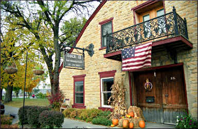
In Balltown, Breitbach's Country Dining has been serving fried chicken and ham steaks since 1852. The oldest continuously operating restaurant in Iowa, it occupied the original frame building until fire destroyed it on Christmas Eve 2007.
Owner Mike Breitbach, whose family has owned it since 1855, replaced it with a new restaurant resembling the original, and it reopened in June 2008. It burned again on Oct. 24, 2008, but again was rebuilt.
From Balltown, the road winds toward Dubuque, up the ridge to the stone houses and brick churches of Sherrill, then down again. Like the whole rolling stretch, it's ear-popping, as well as eye-filling.
Trip Tips: A road trip through northeast Iowa
Fall color: Peak color should arrive in the middle of October.

© Beth Gauper
Events: September, Germanfest in Guttenberg.
Check the Hole in the Sock Gang street theater calendar for its bank robberies, cowboy shootouts and Halloween shows, sponsored by River Junction.
Towns: For more, see Lansing on the Mississippi, Memorable McGregor and Destination Dubuque.
Hiking: Yellow River State Forest has many trails, including the 14.3-mile Backpacking Trail, perfect for an overnight trip. The primitive campsites are free, but campers must register at the forest headquarters on County Road B25, three miles west of Harpers Ferry.
There's also the rustic Firetower Cabin near the forest headquarters, which sleeps six and has a wood fireplace, screened porch, microwave and refrigerator, with a minimum two-night stay. It can be booked a year in advance.
Accommodations: They book quickly for fall weekends. In Lansing, McGarrity's Inn on Main Street has three very attractive rooms with kitchenettes and a one-bedroom suite with a very fancy kitchen, steam shower and whirlpool bath and wrought-iron balcony with bridge view.
The suite sleeps five and adjoins another room that sleeps four.
On the hill, the quieter 1873 Thornton House B&B has five large rooms and a cottage.
In Marquette, the Cobblestone Inn & Suites has many amenities and is pet-friendly.
In McGregor, Little Switzerland Inn rents suites, a room and an 1848 log cabin.
In Guttenberg, The Landing, in an 1858 stone button factory on the river, has 19 modern rooms, including four suites.