Waterfalls of the North Shore
When snow melts along Lake Superior, the rivers start to roar.

© Beth Gauper
Up north, all of the snow that brought you great skiing just keeps on giving when spring arrives.
That's when it turns into waterfalls, roaring down river gorges and misting awed onlookers.
One of the easiest places to see lots of big waterfalls is along Minnesota's North Shore, where dozens of rivers roar down into Lake Superior. Where there's water, there's a waterfall.
When's the best time to go? As soon as ice melts, of course.
Here are some of the most spectacular falls.
The website Great Lakes Waterfalls & Beyond also has a handy section on North Shore waterfalls, plus descriptions and photos of waterfalls around the rest of Lake Superior and beyond.
For more, see Waterfalls of northern Wisconsin and Waterfalls of northeast Wisconsin.
A mile-by-mile guide to North Shore waterfalls
If you start in Duluth's Canal Park, you're at Mile 0.0. Head up Minnesota 61; most of the waterfalls are close to the highway.
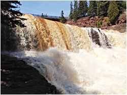
Mile 39.5 Gooseberry Falls State Park. It doesn't cost anything to park here and see the falls, which makes this the most-visited state park except for Fort Snelling in the Twin Cities.
It's a short walk to the Upper, Middle and Lower Falls, and a hike to Fifth Falls.
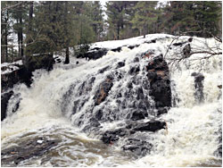
43.5 Split Rock River. From the parking area, there's a great five-mile hike up the west side of the river and around, a rare loop on the Superior Hiking Trail.

© Beth Gauper
50.0 Beaver Bay. On the east side of this town, there's a parking lot from which you can walk to the river and falls. The beach at the mouth of this river is one of the best places to look for agates.
58.5 Tettegouche State Park. Drive inland to the parking lot for trails to three waterfalls on the Baptism River: Two Step Falls, The Cascades and 60-foot High Falls, the tallest waterfall entirely within Minnesota.
60.2 Minnesota 1. This is how you get to Illgen Falls on the Baptism River; for a treat, rent Illgen Falls Cabin and you'll have it pretty much to yourself.
71.3 Caribou River. A 1½-mile trail leads to Caribou Falls.
79.0 Cross River. There's a lovely waterfall here right by the highway, best seen from Lamb's Resort and Campground on the south side of the river. At the river's mouth, you'll find Father Baraga's cross.
80.4 Temperance River State Park. Trails will take you to several falls along this river, seething and twisting like a flume ride from hell. A lot of people swim here, but you shouldn't — several have drowned in recent years.
99.8 Cascade River State Park. Cascade Falls and The Cascades are not far from the highway. The trails that hug both sides of the river are gorgeous, especially in spring, when they're lined by wildflowers.
114.0 Devil Track River. On the rim of this deep, narrow canyon is a 2.4-mile stretch of the Superior Hiking Trail, with views of the red cliffs and waterfalls below.
118.7 Kadunce Creek/River. A trail follows the rust-tinted waters of the Kadunce, cascading to the lake through a narrow gorge.
123.8 Judge C.R. Magney State Park. Trails in this park follow the Brule River past three waterfalls: the Lower, the Upper and Devil's Kettle.

© Beth Gauper
At the Devil's Kettle, the river splits, half cascading 50 feet into a pool and the other disappearing into a pothole; no one know where it ends up.
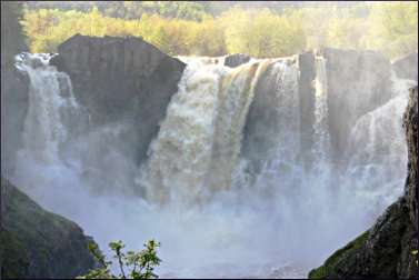
150.8 Grand Portage State Park. The Pigeon River, which marks the international border, is the largest on the North Shore and was the bane of voyageurs. It has so many cataracts that its lower 20 miles are unnavigable.
The big one is High Falls, cascading 120 feet over a sheer basalt wall.
A half-mile, handicapped-accessible trail leads to it. The trail to Middle Falls is three miles.
On the Ontario side of the river, the falls can be seen from Pigeon River Provincial Park. You need a passport to get there.