Twin Cities history ride
On a scenic loop from Minnehaha Park to downtown St. Paul, bicyclists see how it all started.
© Beth Gauper
In the heart of the Twin Cities, one of the most popular bicycling routes also is the most historic.
Below Fort Snelling, the Mississippi and Minnesota rivers meet. Everyone came here . . . in the days before trains and cars, everyone had to come here.
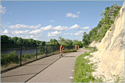
Today, one of the easiest ways to travel this route is by bicycle, and paved trails line both sides of the Mississippi from Minnehaha Park in south Minneapolis to downtown St. Paul.
They form a remarkable 22-mile loop on which you can follow in the steps of the Dakota, fur traders, explorers, soldiers, steamboat captains, railroad barons, archbishops and famous authors.
There's no better way to spend a day. Find out about the people who made the Twin Cities what it is today — or just enjoy the scenery.
Minnehaha Park in Minneapolis
The city's oldest park, built around the famous Minnehaha Falls, is a good place to start.
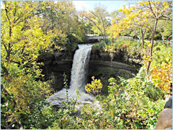
The 53-foot falls on Minnehaha Creek, which connects Lake Minnetonka to the Mississippi River, has been a tourist attraction since the first steamboat arrived in 1820.
But it became famous after the 1855 publication of Henry Wadsworth Longfellow's 'Song of Hiawatha," and schoolchildren paid for the Jacob Fjelde's 1911 statue of Hiawatha preparing to carry the maiden Minnehaha across the water.
If you need a bike, you can rent one at Wheel Fun. You can pick up maps and information at the adjoining Longfellow House, a 2/3-scale replica of the author's home in Cambridge, Mass., if it's open.
Ride south from the west side of the park, past the old Princess Depot, to a paved trail by the dog park.
© Beth Gauper
It's a fast ride down the bluff to the floodplain of Fort Snelling State Park, where the Minnesota River flows into the Mississippi.
On an island now named for him, Lt. Zebulon Pike met on Sept. 23, 1805, with seven Dakota chiefs and got two of them to sign Minnesota's first treaty.
For 60 gallons of liquor, $200 in trade goods and $2,000 paid to traders, the federal government received 100,000 acres of what became Minneapolis and St. Paul, though the Dakota had no idea they'd given it away.
If you want to avoid a steep climb and also ride through parts of Fort Snelling, keep to the right and take a trail that parallels Minnesota 55.
You'll pass Coldwater Spring, whose waters are considered sacred by the Dakota and around which the first soldiers and settlers lived.
Historic Fort Snelling
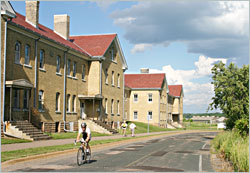
Built on the bluffs over the confluence between 1820 and 1824, this fort now is operated by the Minnesota Historical Society. In summer and on Saturdays in September and October, costumed interpreters lead tours and engage visitors.
Passing through, you'll ride by unused officers' quarters and the stone Round Tower, built around 1820 and likely the oldest building in Minnesota.
Now, cross the Mendota Bridge to the village of Mendota, the Dakota word for "where the waters meet." Fur trader Jean Baptiste Faribault moved here after his log cabin on Pike Island flooded, and John Jacob Astor's American Fur Company built a post here.
Mendota also is the home of Minnesota's oldest church, St. Peter's, founded in 1840. Its first priest, Father Lucien Galtier, was responsible for naming St. Paul.
In September, the church hosts the Mendota Mdewakanton Dakota powwow on its grounds.
© Beth Gauper
Sibley Historic Site in Mendota
Henry Hastings Sibley was a classic frontier opportunist. He came to work for the American Fur Company, built connections in the Dakota community by marrying the granddaughter of a chief, then left her to marry the daughter of a white business associate.
Later, he enriched himself at treaty negotiations, invested in former Dakota land and became the state's first governor. He became a general after the U.S.-Dakota War of 1862, when he led the military commission that condemned 303 Dakota men to death (reduced to 39 by President Lincoln).
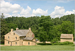
Today, the 1836 stone house Sibley built is operated by the Minnesota Historical Society, which holds a fur-trade rendezvous there in July.
Cross the highway to reach the bike trail, or stop for lunch in the village. Both its restaurants, Axel's and Lucky 13 Pub, are along the trail and have pleasant patios.
© Beth Gauper
Big Rivers Regional Trail
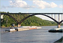
The 4½-mile trail that follows the river is the most scenic part of the loop and is lined with interpretive markers. From Mendota, the trail travels along the bluffs, often with views of the river and downtown St. Paul in the distance.
Then, it descends to the St. Paul Yacht Club and the wooded floodplain of Lilydale Regional Park, passing under the spectacular High Bridge as it approaches Harriet Island.
This section is popular with in-line skaters, too.
Harriet Island Regional Park in St. Paul
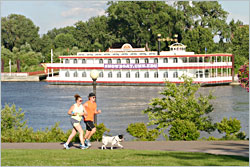
This park, which isn't an island, is across from downtown. Named for Harriet Bishop, a teetotaling Baptist teacher who founded the first public school, it's St. Paul's playground.
The Padelford Riverboats offer cruises from their docks there.
© Beth Gauper
Its stone Wigington Pavilion is named after the nation's first black municipal architect, and there's a bandshell used for many festivals, including Irish Fair in August.
Ride over the Wabasha Bridge, passing over Raspberry Island, which is an island and sometimes is used for concerts.
There are two ways to return.
If you want to continue on bike paths along the river, turn right immediately after crossing the Wabasha Bridge and ride down Second Street to Jackson, at river level.
Turn right onto Shepard Road and follow the Samuel H. Morgan Regional Trail along the river. Markers point out historic sites, including the cave where one-eyed former voyageur Pierre "Pig's Eye" Parrant set up a tavern.
He was the first white resident of St. Paul. The budding settlement briefly was known as Pig's Eye, until Father Galtier was able to rename it.
Continue riding on the bike paths alongside Shepard Road/Mississippi River Boulevard to Ford Parkway or turn into Crosby Farm Regional Park, where paved paths follow the river's shores and continue into Hidden Falls Regional Park.
Ride up the steep hill to Mississippi Boulevard and on to Ford Parkway and across the Ford Bridge back to Minnehaha Park.
The other way to return follows city streets.
Turn left onto Kellogg Boulevard and go past the Science Museum of Minnesota, which includes the National Park Service's Mississippi River Visitors Center.
Continue on the busy street to the imposing Minnesota History Center and turn onto John Ireland Boulevard.
Ride up the hill to two very large buildings.
© Beth Gauper
Cathedral of Saint Paul and the James J. Hill House
The most powerful men in town claimed the blufftop overlooking the river, downtown and the Minnesota Capitol.
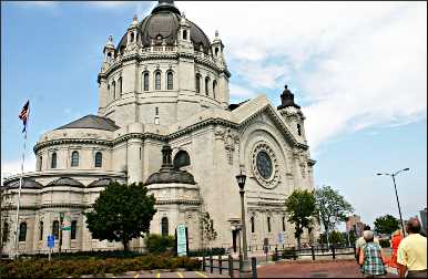
Archbishop John Ireland began building the limestone Cathedral of Saint Paul in 1906. It's the third-largest church in the nation and is open to the public.
Across the street, James J. Hill built the largest house in Minnesota; it took 300 people three years to finish.
Hill was a classic self-made man. As a teen-age bookkeeper at the steamboat landing in St. Paul, he turned a side business selling wood and coal into a transportation empire that included the Great Northern Railway.
They called him the Empire Builder, and his old route, now Amtrak's passenger line across the Great Plains to Seattle, is named for him.
The Minnesota Historical Society operates the house, which is open for tours and special events year-round.
© Beth Gauper
Summit Avenue and the F. Scott Fitzgerald house
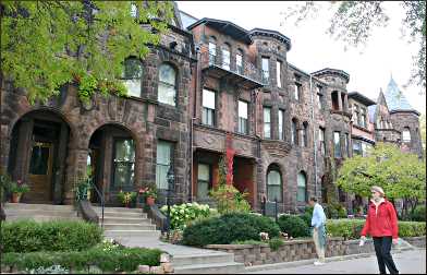
The James J. Hill House is only the biggest mansion of many big mansions on the 4½-mile stretch of Summit Avenue from the cathedral to the river.
It's considered one of the nation's best-preserved collections of Victorian homes, though one of F. Scott Fitzgerald's characters called it "a museum of American architectural failures."
The Jazz Age novelist grew up around Summit Avenue, but unlike most of his friends, he was of modest means, and his books reflect his love-hate relationship with St. Paul's elite.
During the summer of 1919, Fitzgerald completed his first novel, "This Side of Paradise," in a townhouse at 599 Summit Ave. He was born nearby at 481 Laurel Ave.
The staff of the James J. Hill House occasionally offers 75-minute guided walking tours of Fitzgerald's neighborhood.
© Lauren Gagner
Continue along Summit Avenue, which has a wide bicycle lane and is a popular bike route.
Minnehaha Park and beyond
When Summit Avenue meets the river, turn south and follow bike paths to Ford Parkway and Minnehaha Park.
In the park, Sea Salt Eatery is a very popular place to eat seafood or have a beer. There's also a concession selling ice cream and snacks.
From here, you can continue riding north along the river to downtown Minneapolis, the Stone Arch Bridge and the historic milling district.
Or, continue west along Minnehaha Creek to the Chain of Lakes.
Both trails are part of the Grand Rounds National Scenic Byway, which forms a loop around Minneapolis.
More trails take bicyclists into the far suburbs of Minneapolis and St. Paul.
For more, see Bicycling through the Minneapolis suburbs and Bicycling in St. Paul and beyond.