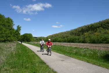
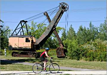
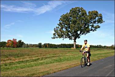
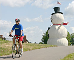
Bicycling in Minnesota
This state's long, paved trails draw eager riders from around the nation.
© Beth Gauper
For Minnesota bicyclists, there are two seasons: winter and trail construction.
That's a good thing, because bicycle tourists crave more trails, and towns crave more bicycle tourists.
Bicyclists love Minnesota's paved trails, and towns have discovered that a little ribbon of asphalt can put it on the map.
"In our area, it seems one city after another is fighting for trails," said longtime Stearns County parks advocate Chuck Wocken.
Stearns County's 28-mile Lake Wobegon Trail, opened in 1998, soon grew to 36 miles, then 46, then 50, then 62.
Now, when linked with the Central Lakes Trail and 10 miles of trail in Morrison County, it's a network of 137 miles.
The longest continuous trail — and the longest paved trail in the nation — is the 123-mile Paul Bunyan State Trail. When linked to the Heartland and Migizi trails, it's part of a 165-mile network.
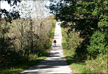
The long trails give Minnesota bragging rights, but it takes at least a weekend to ride them.
Most people want to pedal 20 or 30 miles at a time, usually to enjoy the scenery or to see towns and attractions along the way.
And everyone likes novelty. Whenever I ride a new trail, that one becomes my favorite — the Wobegon, for its churches; the Mesabi, for its curves and emerald-green mine-pit lakes; the Central Lakes, for its wildlife.
And in Minneapolis, the Grand Rounds packs in more scenery (and ice-cream stops) than any other trail in the state.
Minnesota is the nation's fifth most bike-friendly state, according to the League of American Bicyclists, and has 34 cities that have earned "bicycle-friendly" status, more than any other state except California.
For user reviews of trails, check the Rails-to-Trails Conservancy's TrailLink site.
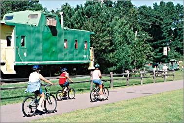
Trip Tips: Minnesota's touring trails
Before you go: Always check the trail's website to see if road construction or flooding has closed part of the trail.
© Beth Gauper
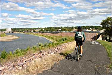
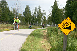
Staying safe: Wear a helmet, even though you're off-road. You're much more likely to fall on your head by locking wheels with another bike or by stopping suddenly than you are to be hit by a car.
Fixing problems: Minnesota has installed more than 30 tune-up stations, including air pumps, on 20 trails. In southeast Minnesota, the Root River State Trail has six stations.
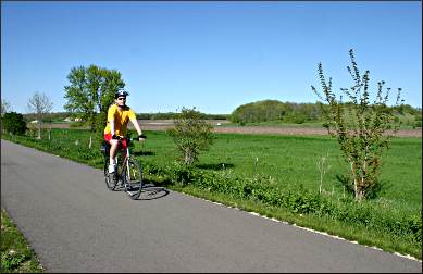
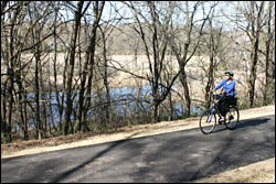
Brown's Creek: East of St. Paul, this six-mile trail starts from the midsection of the popular, 18-mile Gateway State Trail, following a trout stream and gently descending through wooded bluffs to the St. Croix River and downtown Stillwater.
Cannon Valley: This 19½-mile trail between Cannon Falls and Red Wing is one of the most popular in the state. It's a beautiful, shady ride above the Cannon River with a picnic area in Welch, its midpoint.
The trail can be crowded on weekends. In Red Wing, catch the trail off Bench Street, near Pottery Place, or 1½ miles north, off U.S. 61.
The trail is maintained by an association; a daily Wheel Pass is $7.
Central Lakes: It's a 55-mile cruise through rolling landscape dotted with lakes, often on raised beds that give cyclists good views of the countryside from Fergus Falls to Osakis, where it connects with the Lake Wobegon Trail.
Osakis has the best ice-cream stop and a city beach, and the 10½ miles into downtown Alexandria include prairie and lake scenery.
From Alexandria, many people like the six-mile stretch to Garfield, but it includes industrial sites.
The 13 miles from Brandon to Ashby pass many lakes and bogs, with lots of wildlife sightings. It's eight miles to Dalton and another eight to DeLagoon Park in Fergus Falls, all lined with lakes.
For more, see Bicycling the Central Lakes.
Cuyuna Lakes: This nine-mile trail in the Brainerd Lakes area passes a string of mine-pit lakes in Cuyuna Country State Recreation Area between Crosby and Riverton.
Dakota Rail Trail: This lovely, 25½-mile trail in the western Twin Cities starts near downtown Wayzata and passes many Lake Minnetonka villages on its way to St. Bonifacius and Mayer.
For more, see Riding the Dakota Rail Trail.
Douglas: This is a pleasant, 13-mile ride through rolling farmland between Pine Island's city park and the outskirts of Rochester.
© Beth Gauper
Gateway: It's 18 miles from Cayuga Avenue in St. Paul, just west of I-35E, to Pine Point Park in Stillwater Township.
At the four-mile mark, near Lake Phalen, the trail meets the Bruce Vento Regional Trail, which heads south to Swede Hollow, the Bruce Vento Nature Sanctuary, downtown St. Paul and the trails that follow the Mississippi to Minneapolis.
Many people like to start the Gateway in Oakdale, just off Minnesota 36 in the 55th Avenue lot on the south side of at Hadley Avenue, where the trail briefly parallels the highway before it heads into the countryside.
At the 13-mile mark, or five miles from the 55th Avenue lot, the Brown's Creek State Trail heads six miles east to Stillwater.
The Gateway-Brown's Creek Trail Association supports the trails and hosts walks on them.
For more, see Bicycling in St. Paul and beyond.
Gitchi-Gami: This developing trail along the North Shore has a 17-mile segment from Gooseberry Falls State Park through Split Rock Lighthouse State Park to Beaver Bay and Silver Bay.
There's also a 12-mile stretch that links Schroeder, Temperance River State Park, Tofte and Lutsen.
For tips on combining a ride on the Gitchi-Gami with a hike on the Superior Hiking Trail, see Walk 'n' roll.
© Beth Gauper
Glacial Lakes: This scenic trail through the Little Crow Lakes region starts at the Civic Center at the northeast edge of Willmar and winds 22 paved miles northeast, passing the big, festive beach on Green Lake in Spicer, then New London and Hawick.
From New London, bicyclists can ride three miles west to Sibley State Park on the generous shoulder of County Road 148.
For more, see Little Crow lakes.
Glendalough: This gently twisting, 12-mile paved trail makes it easy for people in Battle Lake to ride to Glendalough State Park or for campers to ride into the pleasant resort town for dinner or an ice-cream cone.
Grand Rounds: This national scenic byway through Minneapolis includes 50 miles of bicycle trails around the Chain of Lakes and along Minnehaha Creek and the Mississippi River. Here's a map.
For more, see Biking in Minneapolis.
For more about the many regional trails in the western suburbs of Minneapolis, see Bicycling west of Minneapolis.
© Beth Gauper
Great River Ridge: This 13-mile paved trail connects the southeast Minnesota towns of Plainview, Elgin and Eyota and is near Whitewater and Carley state parks.
The eight miles from the southern trailhead, just north of Eyota at the junction of Minnesota 42 and County Road 9, are lovely, following a winding creek. The five miles from Elgin to Plainview are slightly uphill and follow the highway.
Harmony-Preston Valley: From Isinours Junction, 4½ miles west of Lanesboro on the Root River State Trail, this 18-mile trail goes through Preston and up to the farm town of Harmony.
The 5½ miles from Isinours Junction to Preston, which follow the South Branch of the Root River, are shady and among the prettiest of the whole system. From Preston, the trail follows Camp Creek and also is beautiful.
The last third of the trail, up to Harmony, passes through pockets of forest on the edge of fields and is up and down, with grades of up to 8 percent. Half a mile from Harmony, there's a sinkhole with an interpretive exhibit.
The Harmony-Preston Valley connects to the 42-mile Root River State Trail at Isinours Junction. Together, the two trails are known as the Bluffland Trail.
For more, see Bicycling in bluff country.
© Beth Gauper
Heartland: There are lots of towns to explore on this 47-mile ride between Park Rapids to Cass Lake, through Walker. Dorset, an odd little oasis that has as many restaurants as houses, is a tourist destination. Nevis has shops, cafes and a city beach on Lake Belle Taine.
Akeley is the home of the state's biggest Paul Bunyan, on whose outstretched hand people pose for pictures. Just east of Akeley, the Paul Bunyan State Trail joins the Heartland, and they share the shady stretch to Walker, passing bogs and lakes.
On the west end of Walker, the trail goes under Minnesota 371, and a short spur deposits bicyclists in front of Chase on the Lake hotel and the municipal docks on Leech Lake. On the other side of downtown, there's a sand beach in City Park.
From Walker, the trail follows the western shore of Leech Lake and continues to Cass Lake, much of it near the highway but usually shielded by vegetation.
For more, see Towns of the Heartland Trail.
Lake Wobegon: It's 51 miles from Waite Park, on the west edge of the St. Cloud area, to Osakis. From Albany, there's a 9.4-mile spur to Holdingford and another 10 miles across the Mississippi River to U.S. 10, where it connects to the gravel Soo Line Trail north of Royalton.
In Osakis, the Lake Wobegon connects to the 55-mile Central Lakes Trail.
© Beth Gauper
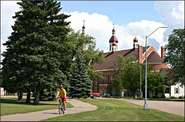
The main section of the Lake Wobegon passes a series of picturesque old churches in the towns that inspired the stories of Garrison Keillor.
For bicyclists arriving on I-94, the trailhead next to the water tower in St. Joseph, just west of St. Cloud, is a good place to start.
Avon, eight miles west of St. Joseph, also is a good place to start, and the city beach on Middle Spunk Lake is a good place to take a dip after biking.
Sauk Centre is the home of Sinclair Lewis, who also chronicled the foibles of middle America. The Caramel Roll ride is held in mid-June.
For more, see Bicycling to Lake Wobegon.
Luce Line: This is the one well-known trail that is crushed limestone, not paved. The granddaddy of Twin Cities bike trails, it starts in Plymouth and runs 29 miles west to Winsted and then is paved another 15 miles to Hutchinson.
It connects to Theodore Wirth Park and the Grand Rounds in Minneapolis by the paved, nine-mile Luce Line Regional Trail.
Two other unpaved trails start in Hopkins. The Lake Minnetonka Regional Trail goes 15 miles to Excelsior and Carver Park Reserve. The Minnesota River Bluffs Regional Trail heads 11½ miles to Chanhassen.
These trails also connect to many regional trails in Three Rivers Park District.
For more, see Bicycling through the Minneapolis suburbs.
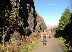
Mesabi: This is the most interesting trail in the state. Built only partly on old rail lines, it dips and climbs around bogs and slag heaps, mine-pit lakes and natural lakes ringed by pines.
On the way, it passes most of the Iron Range's attractions. From the fairgrounds in Grand Rapids, there's a 75-mile stretch east to McKinley; the eight miles between Grand Rapids and Coleraine are very scenic.
© Beth Gauper
The stretch between Virginia to Gilbert also is very scenic, going through rock cuts and on a trestle over slag rock.
There's a four-mile spur between Gilbert and Eveleth, and five miles between Biwabik and Giants Ridge Resort.
A Wheel Pass is $20 yearly, $10 for three days.
For more, see Rolling through the Iron Range.
Migizi: This scenic U.S. Forest Service loop ride around Pike Bay is 19 miles if you count the spur to and from Norway Beach Recreation Area on Cass Lake, streets in the town of Cass Lake and nearly three miles south of Cass Lake along Minnesota 371.
Bicyclists arriving on the Heartland north from Walker turn east at Pike Bay and ride through lovely pine forests of Chippewa National Forest and past the South Pike Bay campground, where half the sites have their own sand beaches.
The trail hugs the east side of Pike Bay and heads to Norway Beach, where there's a lakefront campground, a sweeping sand beach and a magnificent 1935 log and stone visitors' center built by the Civilian Conservation Corps.
Then it winds into the town of Cass Lake and heads south. Expect bald-eagle sightings; migizi is Ojibwe for eagle.
Mississippi River Greenway: This paved trail follows the river 11 miles from Kaposia Landing Park in South St. Paul to Pine Bend Bluff scientific and natural area in Inver Grove Heights.
There's a five-mile gap to Spring Lake Park, from which the trail continues another 10½ miles to Levee Park in Hastings, where it connects to city trails.
© Beth Gauper
Paul Bunyan: This 123-mile trail winds through lake country between the Brainerd area and Bemidji.
The southern trailhead is Crow Wing State Park, six miles south of Baxter. The trail passes the remnants of a ghost town and follows the Mississippi River to Baxter, where the trailhead is off Minnesota 371 at Excelsior Road (parking is near Northland Arboretum.
The 15 miles to Nisswa is the trail's quietest stretch. After Nisswa, the trail follows 371, separated by trees, until three miles north of Pequot Lakes, where it loses its tree cover until Backus.
The seven miles from Backus to Hackensack and the nine up-and-down miles through Chippewa National forest, nicknamed "The Pyrenees" (there are grades of up to 8 percent), are very scenic.
On the north side of Minnesota 34, 2½ miles east of Akeley, the Bunyan joins the Heartland State Trail for the 7¾-mile ride to Walker.
From Walker, the Bunyan heads northwest to Bemidji. The 7½-mile stretch along the east edge of Lake Bemidji to Bemidji State Park is very scenic, crossing the Mississippi River as it leaves the lake and heads east.
It's also possible to continue around Lake Bemidji on quiet roads and city sidewalks. The whole loop is a very nice 17-mile ride.
For more, see Bicycling the Bunyan.
© Beth Gauper
Red Jacket: This county trail heads 6½ miles from Mankato's South Riverfront Drive to Rapidan. At County Road 90, it bisects the eight-mile South Route Trail; from there, it's about four miles to Minneopa State Park.
The Minnesota River Trail, which connects the Red Jacket and Sakatah Singing Hills State Trail, is about four miles.
For more, see Mankato meander.
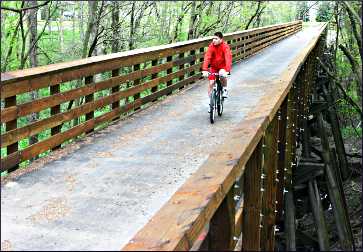
Root River: This 42-mile trail, in lovely bluff country between Fountain and Houston, is Minnesota's pride and joy.
There's a long downhill from Fountain to Isinours Junction, from which the trail follows the Root River, crossing dozens of bridges as it goes through Lanesboro, Whalan, Peterson and Rushford.
From there, the trail departs from abandoned rail line and becomes especially scenic, climbing a steep hill on its way to Houston, where the Houston Nature Center offers showers.
Much of it is shady, and the area's lack of standing water means there are few mosquitoes.
It connects to the 18-mile Harmony-Preston Valley Trail west of Lanesboro at Isinours Junction. Together, the two trails are known as the Bluffland Trail.
For more, see Bicycling in bluff country.
© Beth Gauper
Sakatah Singing Hills: This low-profile, 39-mile trail between Faribault and Mankato has a mixture of scenery. Between Faribault and Waterville, it skirts lakes along a shady corridor.
From there, it plunges into cool woods, passing Sakatah Lake State Park (Sakatah is Ojibwe for "singing hills"; it's pronounced Sah-KAH-tah) and Elysian, where flocks of pelicans hang out on Lake Elysian.
West of Madison Lake, the trail is away from the highway but on open fields.
In Faribault, start off County Road 21, on the south side of the Cannon River, or along Minnesota 60 just west of I-35. In Mankato, the trailhead is on Minnesota 22, near its junction with U.S. 14.
The lakes are pretty but shallow; in late summer, they can be full of algae, making swimming unpleasant.
Shooting Star: This 30-mile southern Minnesota trail follows the Shooting Star Scenic Byway from LeRoy, on the Upper Iowa River near the Iowa border, to the east side of Austin, just south of Hormel Nature Center, where it connects to city trails.
The eastern half, which goes through Lake Louise State Park, is most scenic. Adams has a public outdoor pool, a park and a cafe.
© Beth Gauper
Soo Line: The 11-mile Soo Line Trail cuts through countryside on Mille Lacs' south shore, between the old depot behind Onamia's Main Street to the playing field in Isle.
From Onamia, it's a six-mile ride on County Road 26/27 to Mille Lacs-Kathio State Park. In Isle, Father Hennepin State Park adjoins the town, and riders can use its beautiful lakeside trails and beach.
Unfortunately, riders on the adjoining ATV trail spew gravel and rocks, some of them palm-size, onto the trail.
For more, see Life on Mille Lacs.
Sunrise Prairie/Hardwood Creek: These county trails, just north of the Twin Cities, roughly follow Interstate 35.
The prettiest stretch is the 10 miles from Stacy to North Branch on the 16-mile Sunrise Prairie Trail, which winds past bucolic meadows and wetlands and is out of earshot of the highway. It's flat and ideal for children, and there's a playground in Stacy.
The Sunrise Prairie continues south from Wyoming and meets Washington County's Hardwood Creek Regional Trail, which follows U.S. 61 for 9½ miles from Forest Lake to Hugo.
© Beth Gauper
Willard Munger: This 75-mile trail between Hinckley and Duluth is one of the oldest and longest paved trails in the nation.
The stretch from Hinckley to Barnum is known as the Fire Trail, as it passes through countryside scorched by the cataclysmic Hinckley Fire of 1894 and Cloquet and Moose Lake Fire of 1918, each of which killed more than 400 people.
The trail starts in Hinckley near the Fire Museum and continues to Willow River along a rail corridor that was the scene of a dramatic rescue. From Barnum, the trail follows Minnesota 61 into Carlton.
For more, see The Fire Ride.
The next 14½ miles, through gorgeous Jay Cooke State Park, along the St. Louis River and downhill to the Duluth trailhead, in front of the Lake Superior Zoo, may be the most scenic stretch of trail in the state.
More trails: For shorter and developing trails, check Minnesota's DNR trails list.
Bicycle tours: Many of these trails host annual bike rides. For more, see Tours on two wheels.